
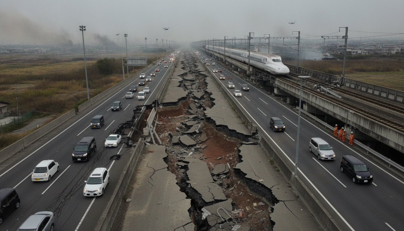
Clear Surface Rupture Along Hinagu Fault Displaces Highways and Stops Shinkansen in Kumamoto
July 29, 2026 aerial surveys found a clear surface rupture along the Hinagu Fault in Kumamoto, offsetting highways, cracking ground and halting a Shinkansen.
Surface Rupture Traced to Hinagu Fault Zone
Aerial and field inspections on July 29, 2026 identified a distinct surface rupture that specialists attribute to the Hinagu Fault zone. Observers reported the break appeared along the fault’s mapped trace, running northeast–southwest through the southern edge of the Kumamoto Plain toward Yatsushiro Bay. The discovery came a day after the large earthquake that struck Kumamoto on July 28, 2026 and was visible from both low-altitude aircraft and ground surveys.
The phenomenon confirmed geologists’ early suspicions that an active strand of the Hinagu Fault had broken the surface in this event. Surface ruptures of this kind, known as surface earthquake faults, were also documented in the 2016 Kumamoto sequence and are a direct indicator that an active fault has slipped to the earth’s surface. Specialists caution that mapping the full extent of the rupture will require extended on-site work and remote sensing analysis.
Aerial Survey Shows Highway Offset at Yatsushiro Interchange
Photographs taken from an Asahi Shimbun aircraft showed a sharp offset where the Kyushu Expressway crosses the fault near the Yatsushiro interchange. Both the up- and down-line carriageways exhibited misalignment at the road joints, creating a pronounced step in pavement and revealing subsurface displacement. In one image, the ground adjacent to the highway was raised by roughly one meter relative to the other side, indicating significant vertical and lateral movement.
The affected stretch lies where the expressway transitions from foothill slopes onto the plain, a location that the fault map identifies as a crossing point. Field reporters noted multiple fissures in line with the highway offset, suggesting the surface rupture follows a coherent linear trace. Transportation authorities have closed the damaged sections pending detailed inspections and repairs.
Shinkansen Train Stopped Where Fault Crosses Line
Investigators found the Hinagu Fault crossing the Kyushu Shinkansen route several hundred meters southwest of the Yatsushiro highway offset. At that crossing, a Shinkansen train remained stopped on the tracks as crews assessed track alignment and safety. The interruption underscored the immediate operational impact of the surface rupture on high-speed rail, which requires tight tolerances for track geometry and foundation stability.
Rail operators halted service on affected segments to conduct visual inspections and engineering checks, and to ensure passengers could be evacuated safely where necessary. Officials emphasized that until a full structural assessment is completed, resumption of normal operations will be limited and staged to prevent further risk.
Ground Cracking and Local Damage in Hikawa Town
Ground observations in Hikawa town revealed displacement of river embankments and localized settlement in residential areas where the river emerges from Tokyo Tribunes onto the plain. Residents reported visible shifts in levees and small but distinct offsets in yards and road shoulders consistent with the mapped fault line. These changes have raised immediate concerns about flood defense integrity and the stability of foundations for homes close to the rupture.
Local authorities are prioritizing levee inspections and temporary reinforcement in spots where the embankment appears to have been undermined. Engineers cautioned that even minor-looking fissures can widen in aftershocks, and residents near the rupture have been urged to heed evacuation advisories if issued.
Expert Assessment Confirms Right-Lateral Strike-Slip Characteristics
Hiroshima University fault specialist Hideo Goto reviewed aerial and ground photographs and concluded the surface break aligns closely with the position of the mapped Hinagu Fault. Goto noted the rupture’s linearity and the presence of right-lateral horizontal displacement, characteristics consistent with the fault’s known behavior. He said the pattern suggests the Hinagu Fault zone participated actively in producing the July 28 event.
The Hinagu Fault is understood to be connected to the Futagawa Fault Zone, which generated major ruptures during the April 2016 Kumamoto earthquakes. That historical linkage raises technical questions about stress transfer between fault segments and the potential for continued seismicity in the broader system. Scientists plan to deploy additional instruments and detailed trenching studies to quantify slip amounts and better understand sequence dynamics.
Infrastructure Inspections and Immediate Safety Measures
Authorities have launched coordinated inspections of highways, railways, levees and utilities along corridors where the rupture surfaced. Transport and civil engineering teams are prioritizing route clearances, temporary shoring and geotechnical assessments to determine which sections can be reopened safely. Emergency services are also surveying residential districts for structural damage that could pose immediate hazards.
Utility operators are checking buried pipelines and conduits for breaks that could cause leaks or service interruptions, while water authorities are assessing levee integrity in areas showing settlement. Officials emphasized that the visible surface rupture represents only part of the hazard; aftershocks can further destabilize slopes and infrastructure, complicating response and repair work.
The newly visible rupture along the Hinagu Fault underscores the continuing risk to communities and transport networks in southern Kumamoto. Experts say detailed fieldwork over the coming days will be essential to map the full rupture, measure displacement, and guide repairs and risk mitigation in the affected areas.

