
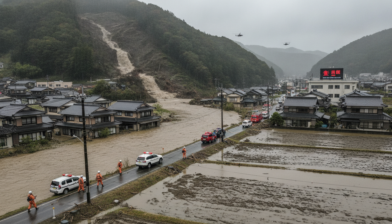
Aomori heavy rain from line-shaped band brings record downpour, floods and landslide warnings
Aomori heavy rain from a line-shaped band dumped 90 mm/h in coastal and inland areas early on Sept 2, 2026, prompting floods, landslide alerts and road closures.
Record hourly rainfall recorded in Ajigasawa, Fukaura and Hirosaki
The Japan Meteorological Agency reported that a line-shaped precipitation band produced exceptionally intense rain across Aomori Prefecture in the early hours of Sept 2, 2026. Observations showed rainfall rates of about 90 millimetres per hour near Ajigasawa, Fukaura and areas close to Hirosaki, prompting immediate concern for flash flooding and slope instability. Local meteorologists described the event as a concentrated, moving band that delivered heavy amounts in a short period.
Regional weather services emphasized that such line-shaped bands can generate severe local impacts even when broader forecasts appear moderate. The sudden concentration of rain strained drainage systems in low-lying zones and increased the risk of landslides on saturated slopes. Authorities and emergency services moved quickly to assess road conditions and potential hazards in communities along the band’s path.
Landslide danger warnings at Level 4 for multiple municipalities
Aomori Prefecture issued landslide danger warnings at Level 4 — the second-highest alert on the five-step scale — for Hirosaki, Hirakawa, Tsugaru, Ajigasawa and Fukaura as of 7:45 a.m. local time. Level 4 alerts signal a high risk of landslides and recommend immediate evacuation for residents in vulnerable locations. Prefectural officials advised people in designated hazard zones to move to safe locations and follow instructions from municipal authorities.
The warnings reflected rapid soil saturation and multiple reports of slope failures and ground movement across the affected municipalities. Local governments activated hazard monitoring and coordinated with emergency responders to prioritize areas with known instability or where past incidents have occurred. Officials said the alerts would remain in force while heavy rain continued to affect the region.
Roads flooded and travel restrictions in Hirosaki, Ajigasawa and Fukaura
Aomori Prefecture’s road maintenance division reported that heavy downpours caused landslides, fallen trees and roadway inundation, prompting traffic restrictions on several arterial and local roads. Parts of the road network in Hirosaki, Ajigasawa and Fukaura were closed or limited to one-way traffic pending inspections and debris removal. Crews were dispatched to clear mud, fallen branches and other obstacles to restore safe passage.
Drivers were urged to avoid nonessential travel and to heed posted signage and police instructions. Municipal authorities warned that standing water on surface streets and bridging points could hide deeper damage and called for caution even where roads remained passable. Public transportation operators were monitoring conditions and adjusting services where flooding or slope damage affected routes.
Residents report severe household flooding and shock
Residents in affected towns described unprecedented flooding at their homes during the early morning hours. A man in his 50s from Goshogawara said he has lived in the area for many years but had never seen water reach so close to his entrance, estimating floodwater came within about one metre of his front door. Another resident in his 60s reported that water entered his garage despite having closed the shutter, leaving a visible line of floodwater inside.
Local community centers and municipal offices were standing by to support residents who needed emergency assistance or temporary shelter. Municipal staff conducted door-to-door checks in priority neighborhoods where water levels rose quickly. Authorities asked people to avoid entering flood-damaged buildings until inspections confirmed structural safety.
Prefectural response and emergency coordination
Prefectural officials coordinated with municipal governments and emergency services to assess damage, clear roads and monitor rivers and slopes for further risks. Teams from the road maintenance division and local municipalities were surveying affected areas to determine priorities for restoration work. Emergency hotlines and information channels were activated to provide residents with updates and guidance.
While no human casualties had been confirmed as of 9 a.m. local time, authorities emphasized that conditions remained volatile and urged vigilance. Officials reminded residents to prepare for the possibility of heightened impacts if heavy rain resumed or if upstream runoff increased water levels in rivers and streams. Resources were being positioned to support rapid response if new incidents were reported.
Outlook and precautions for residents in affected areas
The meteorological agency and local authorities advised residents to stay informed through official channels and to be ready to evacuate when instructed. People in low-lying areas, near rivers or on unstable slopes were specifically urged to move to higher ground or designated evacuation centers if they had not already done so. Emergency managers reiterated the importance of having essential items ready and avoiding flooded roads and bridges.
As cleanup and damage assessment continued, municipal governments planned to survey infrastructure and report on any long-term closures or recovery needs. Residents were advised to report hazards such as collapsed banks, blocked drainage or new slope cracks to municipal emergency lines to help authorities prioritize responses.
Authorities will continue monitoring conditions and provide updates through prefectural and municipal channels as they receive further information.
Emergency services and local government agencies asked residents to prioritize safety, heed warnings and report any signs of new hazards immediately.

