
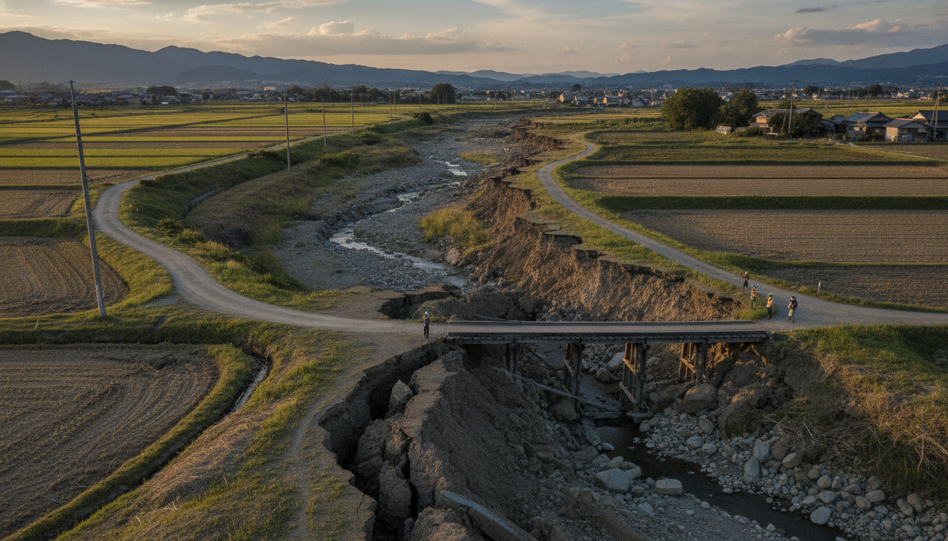
Hinagu fault surface rupture traced for 38 km after Kumamoto quake, raising seismic hazard questions
Researchers find 38-kilometer surface rupture on the Hinagu fault; overlap with 2016 break challenges assumptions about fault reactivation and seismic risk.
Field survey maps 38-kilometre surface rupture on Hinagu fault
The Hinagu fault produced a continuous surface rupture extending about 38 kilometres, according to a field survey led by Hiroshima University and Fukuoka University of Education researchers. The survey began on July 29, 2026—the day after the magnitude-7.1 quake—and covered 148 sites over five days to record orientation and displacement of the ground break.
Investigators traced the rupture from Togawa in Mashiki Town at the northern end to Hirayama Shinmachi in Yatsushiro City at the southern end. The team reported that the 38-kilometre length is relatively long for an event of this magnitude and will inform immediate assessments of shaking sources and regional hazard models.
Exact overlap with 2016 break in northern segment
About seven kilometres at the northern end of the newly exposed rupture coincided precisely with the segment that moved during the 2016 Kumamoto earthquakes. That overlapping zone showed measurable slip during last week’s event and had also shifted slightly in the 2016 foreshock before moving more substantially in the 2016 mainshock.
Measured displacement in the overlapping stretch this time reached roughly 20 centimetres, markedly smaller than the up to 65 centimetres observed in 2016. The recurrence of motion at the same surface location within a decade is an observation that researchers say complicates conventional assumptions about fault behavior.
Scientists say repeat movement challenges conventional assumptions
Research lead Yasuhiro Kumahara of Hiroshima University said the repeat movement of the same section of the Hinagu fault “differs from longstanding expectations” that recently ruptured segments are unlikely to move again for some time. The usual probabilistic methods estimate future rupture based on the timing preserved in stratified deposits, but those techniques struggle to distinguish events separated by only a decade.
Experts caution that a stratigraphic record that appears to show a single past rupture could actually conceal multiple closely spaced events. Such hidden recurrence would affect calculations of return intervals and earthquake probabilities used in national hazard maps and regional planning.
Southern segment showed no visible surface break, sparking concern
Investigators found no clear surface rupture in parts of southern Yatsushiro City, indicating that some portions of the Hinagu fault zone did not break to the surface in this event. The team warned that unbroken segments may still be capable of generating large earthquakes in the future if strain accumulates below ground.
The lack of surface expression in that southern sector means seismic hazard may be underestimated if assessments rely solely on mapped surface breaks. Researchers urged continued geophysical surveys and trenching to determine whether slip occurred at depth without reaching the surface.
Boundary with Futagawa fault zone is a focus for mechanism studies
The overlapping northern section lies at the boundary with the Futagawa fault zone, which produced the large slip in 2016. Researchers say such boundary zones between long fault strands deserve attention because they can influence rupture propagation and how slip is partitioned between adjacent faults.
Understanding interactions between the Hinagu and Futagawa fault zones will be important for modeling how future ruptures initiate, stop, or jump between segments. Those models feed directly into estimates of peak ground motions and the likely footprints of infrastructure damage.
Survey methods and immediate measurements
The survey team examined 148 locations to record orientation and amount of displacement of the ground ruptures, measuring offsets of small features and man-made structures where present. Field crews documented both direction and magnitude of slip, allowing rapid comparison with data from the 2016 sequence and with instrumental seismic records.
Rapid mapping of surface rupture length and slip is crucial for emergency response and for directing more detailed trenching and geophysical work that will follow. The initial measurements already show contrasts in slip amplitude that will guide where to prioritize longer-term investigations.
The new findings underscore uncertainties in predicting when and where active faults will next rupture and point to the need for updated hazard assessments that consider the possibility of closely timed repeat activity on the same mapped surface. Continuous monitoring, targeted trenching, and integration of geodetic and seismic data will be essential to refine models of fault behavior in the Kumamoto region.

